


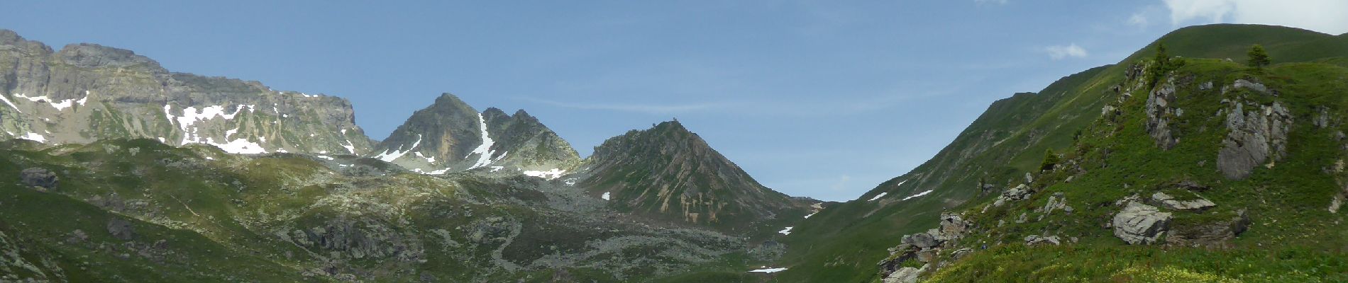
F73 Beaufortain J1 Saint Guérin la Balme via col du Mont Rosset

ageo
User
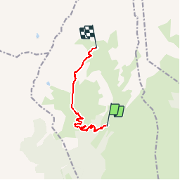

Length
7.8 km

Max alt
2337 m

Uphill gradient
759 m
Km-Effort
16.5 km

Min alt
1590 m

Downhill gradient
343 m
Boucle
No
Creation date :
2018-07-06 20:24:26.671
Updated on :
2018-07-07 07:27:44.138
3h29
Difficulty : Medium

FREE GPS app for hiking
 SityTrail
IGN / Geographical institutes
SityTrail Plus
The world is yours!
About
Trail Walking of 7.8 km to be discovered at Auvergne-Rhône-Alpes, Savoy, La Plagne-Tarentaise. This trail is proposed by ageo.
Description
File with points/tracks from Locus Map/3.31.3
Photos


Positioning
Country:
France
Region :
Auvergne-Rhône-Alpes
Department/Province :
Savoy
Municipality :
La Plagne-Tarentaise
Location:
Unknown
Start:(Dec)
Start:(UTM)
318617 ; 5052856 (32T) N.
Comments